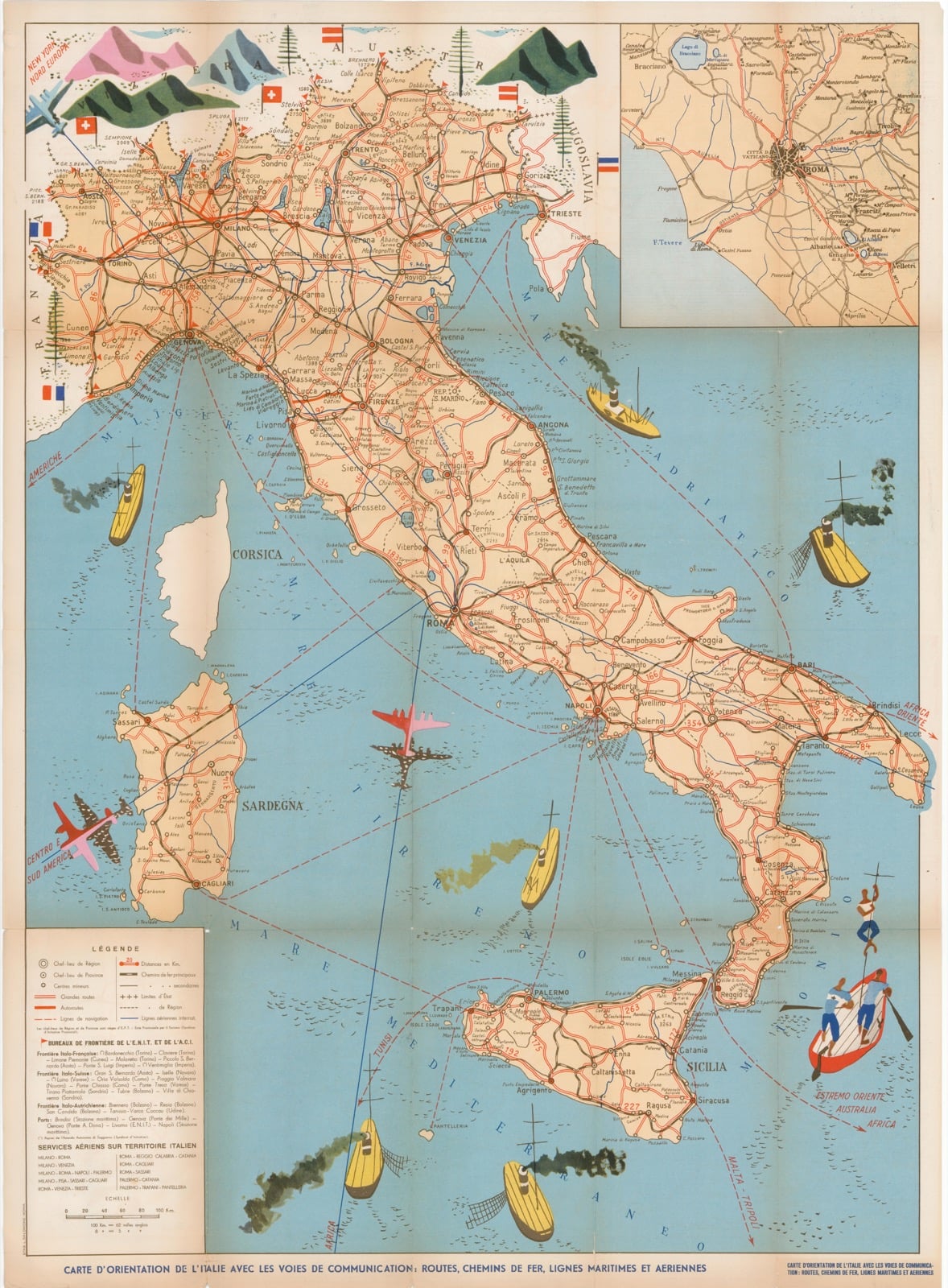
Author: E.N.I.T.
Date: 1953
Technique: Lithography
Size: 79,5x58,5
Decorative large map of Italy showing the communication routes of the peninsula enriched by cartoons with airplanes and boats with the relative routes. The map, repeatedly folded on itself, allows a comfortable reading of the verse where there are delightful pictorial and descriptive illustrations in the French language of the Italian regions. Top left large insert with Rome and its territory. Published for the Banca Nazionale del Lavoro by the lithography Solomon in 1953.